Piri Reis Map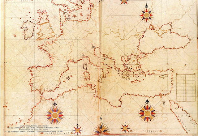

In 1929, a group of historians made what can only be described as an amazing discovery, written on the skin of a gazelle. After study and research, they found that it is a genuine map drawn in 1513 by Piri Reis, a well-documented admiral of the Turkish navy. He depicts Europe and North Africa, the coast of Brazil, several islands (The Azores, Canary Islands, and the mythical island of Antilia), and even Antarctica, which was thought to be discovered more than 300 years later. The most puzzling thing is not that it shows we need to rethink the chronology for a number of exploratory discoveries, but that it describes Antarctica’s topography as not being masked by ice and in great detail. The last time that occurred was more than 6000 years ago.
Tell me then. How did a Turkish admiral from half a millennium ago map a continent that’s been covered by ice for the last 6000 years?


So, where's the rest of the map?
ReplyDelete